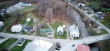
FEMA is currently updating the Flood Insurance Rate Maps (FIRMs) in Vermont for the National Flood Insurance Program (NFIP). This will be the first map update for many towns since the 70’s or 80s. Some Vermont counties received official “digital” FIRMs in 2007 but most of the flood hazard areas did not get fresh studies. This new update will cover the entire state in stages and may become effective in some counties as soon as 2025.
Discovery Meetings have already happened around the state kicking off the process that usually lasts about four years (though it could be faster). We outline the steps below, but know that you should try to complete your bylaw updates before the Prep Deadline. The processes take time so start early. The most frequent problem that towns experience with this process is not leaving enough time for unexpected bumps along the way, such as revising a bylaw that was rejected by the Select Board, voters, or FEMA. If you can’t finish in time and residents lose flood insurance, they are very vulnerable.
This page provides the details of the process, and your Regional Floodplain Manager is ready to help you through it. FEMA has also provided an outline of the process and resources for community officials. These are helpful, and the details below are tailored for Vermont communities.
Sections on this page:
- Why This Matters for Your Town
- Who’s Involved?
- The Bylaw Update Process
- The New Maps
- How to View the Preliminary DFIRM Maps
- Process Status By County
Why This Matters for Your Town
When the new maps go into effect, FEMA requires that town bylaws meet current standards for participation in the NFIP. If your bylaws are not sufficient, residents will no longer be able to purchase nor renew flood insurance through the NFIP. Now is the time to update your bylaws.
You also have the opportunity to ensure your town qualifies for 92.5% disaster funding through the Emergency Relief and Assistance Fund (ERAF). That’s an additional 10% of public disaster recovery costs that the state will cover instead of local taxpayers. Read more about financial liabilities and opportunities.
Most importantly, this is an opportunity to provide additional safety for your community. Intense storms are getting more frequent and disproportionately harming the most vulnerable members of our community (read more on this site and our Flood Ready site). Make sure you’re protecting the buildings, roads, and bridges that already exist in your community by preventing further risky development in hazardous areas. This is a national movement as all states grapple with increasing flood disasters, and over ⅓ of Vermont’s towns (as of early 2022) have already adopted this strategy. There’s much more detail on this approach on the Protecting Your Community With a No Adverse Impact Approach page.
Already Updated?
If you updated your bylaws to regulate development in special flood hazard areas (SFHA) or river corridors in the last 20 years, it’s still worth revisiting them to ensure they fit the current NFIP requirements, state guidance, and the flood resilience efforts in your Municipal Plan. You can check your town in the Expanded Community Report tool, and if you find that your ERAF rate is not 17.5%, then you have room to further protect your community. That report also provides additional information about your community’s exposure, such as how many buildings are in the SFHA and how many flood insurance policies exist.
Who’s Involved
A lot of folks may be involved in each step of the process:
- Your Planning Commission will start the review and update process, and work with the community.
- Your Select Board will consider and approve bylaw updates, or sometimes there will be an Australian ballot.
- Your Floodplain Administrative Officer and Development Review Board can advise during the process.
- Your Regional Planning Commission may assist with the updating process and public engagement, or private planners may also be contracted to assist.
- Your Regional Floodplain Managers at Vermont Department of Environmental Conservation (DEC) provide model bylaws to use, and advice on customizations that will meet FEMA’s and Vermont’s requirements.
- FEMA is updating the maps and reviewing bylaws to ensure compliance.
The Map and Bylaw Update Process
The most important thing: Give yourself time. Two to four years may feel expansive, but if you don’t start early, it will be stressful, potentially ineffective, and you may miss the deadline, putting residents at risk.
“Start the process as soon as you are able, even before FEMA contacts your town. Unprotected floodplains and river corridors are a risk to your community, and once a house is built, that impact is locked in for generations, or until a river washes it away.” – Ned Swanberg, Regional Floodplain Manager
Step 1: Discovery Meeting with FEMA
Discovery Meetings have been completed across Vermont. FEMA contacts the chief elected officer and other municipal officials to participate. At the Discovery Meeting, FEMA shares the data and map drafts that they have developed and ask you about your local knowledge of hazard areas and places that they should potentially study further. To inform this conversation, it is often helpful to invite representatives from your road, and fire / first responder departments and anyone else who might have a good understanding of where flooding is happening or new developments that may impact flooding, particularly in Zone AE areas. This is also the time to bring all fresh detailed studies that have been completed in town that show more accurate flood hazard areas or Base Flood Elevations (BFE).
After the meeting, the town will then have 30 days to provide FEMA with additional information that would help prioritize areas across the watershed to study, leading to more accurate maps.
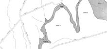
The results of the process are provided in a Discovery Report. The report summarizes the information available and identifies how the study will proceed, and which river reaches will get updated detailed studies. You can see here what studies have been selected by county.
![]()
Step 2: Plan Updates
You don’t have to wait for the FEMA meeting to start this process. Start it as soon as you can.
Your Municipal Plan or Local Hazard Mitigation Plan must be valid
before updating your bylaws. The Municipal Plan needs to be updated every 8 years. Check your town in the Expanded Community Report tool to see when these plans will expire. Your bylaws execute your plans, so make sure they represent the vision your community has for your future. Your Regional Floodplain Manager can help you understand what updates might be beneficial, even if the plans have not expired.
If you decide it’s time to update your Municipal Plan, read this process. We also have guidance on updating your Local Hazard Mitigation Plan. Plan updates can take years, so ensure you set a timeline that will complete with plenty of time to still update bylaws before your FEMA maps are complete.
![]()
Step 3: Bylaw Updates
You don’t have to wait for the FEMA meeting to start this process. Start it as soon as you can.
Step 3A: Know Your Risks and Opportunities
Start with a good sense of where you’re already at. Check your town in the Expanded Community Report tool. In the ERAF status column, if anything has a “no” value, that is an opportunity to improve the safety of your community and increase the public assistance funding your town can receive. You can see how many buildings are located in hazard areas and how many are insured. You can see your current status with the NFIP and the Community Rating System (CRS). You can see when your Municipal Plan was last updated, and when it will reach its 8-year renewal point.
But what does it all mean? How much risk to residents and reliable roads does your community really face? This is a great time to talk with your Regional Floodplain Manager or your Regional Planner to discuss your risks and opportunities so that you can get a sense for how you’d like to proceed through the next steps. You have an opportunity to improve safety and security for your community for generations to come. Read more about protecting your community. FEMA also provides several tools for assessing risk in floodplains.
Step 3B: Review Your Current Bylaws
If you already have bylaws regulating hazard areas, review them with your Regional Floodplain Manager to answer these questions:
- Do they achieve the flood resilience elements in your Municipal Plan?
- Do they avoid increasing risk to your family and neighbors?
- Do they protect the critical functions of floodplains and river corridors?
- Do they protect town roads and investments, and provide reliable roads for work, school, and critical needs?
- Do they support meaningful action to reduce risk to people already living in harm’s way?
Step 3C: Draft an Update
Once you understand your risks, opportunities, and current bylaws, the Planning Commission should draft new bylaws. Consider starting in April after new boards have formed and completing adoption in October before end-of-year holidays.
This step could consist of updating existing bylaws or building from the DEC’s model bylaws. The model bylaws will allow your residents to purchase insurance through the NFIP, ensure your town gets the maximum public assistance to recover from disasters, and stop your community from adding risk to existing structures. Read more about the model bylaws and opportunities for customization.
Work closely with your Regional Floodplain Manager during the bylaw creation process so they can help you avoid missing out on opportunities. If you start with the model bylaws and decide to amend them, consider tracking all changes so that your manager can quickly see them as they review your update. Make sure you have additional time for customization.
It’s important to build community understanding and support during this process so that your neighbors understand what is changing and how the changes will benefit their community. During the drafting process, hold informational meetings and public hearings. Visit our community engagement page for ideas and enlist help from your Regional Planning Commission. Make sure you’re able to hear and discuss concerns and consider how you might integrate them into the updates. By the time this process reaches the next phase of Select Board review, it’s more difficult to iron out sticking points and you may risk repeating the entire process.
Send the final draft to your Regional Floodplain Manager for a review. The manager will check for compliance with the FEMA requirements. Once it’s done, send it on to the Select Board.
Our first Planning Commission meeting was heated, but we got through it. We had done extensive research ahead of time so we could explain why the proposed regulations are in line with our community values and the thinking behind each part. We invited folks who were concerned about the bylaws to come to our next commission meetings so we could fully hear their concerns and discuss amendments that would both meet their needs and our goals. Taking the time to listen and get creative made these updates possible. And we’ve come back to amend them as new needs arose that we didn’t foresee. - Melissa Manka, Westford Town Planner
Step 3D: Select Board Consideration
Ideally, the Planning Commission and Select Board have communicated throughout this process and there are no surprises during this step. You want to have done your outreach with the board members and the community to feel confident these bylaws will be adopted.
The Select Board warns and holds a public hearing and completes the adoption of the new bylaws. Some communities may require a town meeting vote. If the Select Board amends the bylaws at this stage, the Regional Floodplain Manager will need to check the new language for compliance again. Anticipate these possibilities and make sure there is ample time to accomplish them.
If you have any concern that the bylaws update may not pass, plan for enough time both to do the outreach ahead of the vote and to redo the process if not enough consensus is built to pass.
![]()
Step 4: FEMA Review & Approval or Rejection
The Regional Floodplain Manager will send the new bylaws to FEMA for approval, along with review notes that indicate compliance with FEMA’s standards.
FEMA will review for compliance. This usually takes at least two weeks and might be much longer if there’s a current disaster requiring FEMA staff time. Unless the Regional Floodplain Manager has indicated that there may be problems with compliance, it is very likely to be accepted. Hooray! You’ve made it through the bulk of the work and there’s only a bit left to go.
If FEMA determines that your bylaw is not in compliance, you will receive feedback and can go back through the drafting and adoption process. This possibility is one example of why it’s critical to leave plenty of time in the process to ensure your residents don’t lose insurance coverage.
![]()
Step 5: FEMA's Presentation of New Flood Insurance Rate Maps (FIRMs)
FEMA will coordinate with the Chair of the Select Board at different stages. In counties without existing DFIRMs we anticipate a County-wide Work Map Meeting. Minor issues, such as labeling errors, are easily corrected during at the Work Map stage. Simply communicate them to your FEMA representative.
Later, after the Preliminary FIRMs and Flood Insurance Studies have been released, a Community Consultation Officer Meeting (CCO) will be set up. At these meetings officials across the county will review the maps together, discuss what changed, and answer questions.
FEMA will also set up an Open House meeting for the public to discuss the new maps, the flood risk they show, and how people can secure flood insurance and protect their buildings.
![]()
Step 6: Appeal Opportunity
If you discover substantial errors or surprises in the Preliminary Maps and Studies, the Town may formally appeal the data within the 90 day Appeal Period. The town will usually need to provide higher quality engineering data to supersede FEMA’s preliminary data.
![]()
Step 7: Process Completion
Once any appeals have been resolved, FEMA will notify the town of an effective date (at least six months later) for the new maps, with a Letter of Final Determination. Maps go into effect for an entire county at once. You will also receive a Summary of Map Actions that describes which existing Letters of Map Amendment (LOMA) will remain valid.
Let your residents know of the changes so that they can determine if their property is now in a hazard area. Here's a poster template that could help. You could adapt this language for Front Porch Forum or a newsletter tool as well.
![]()
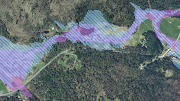
The New Maps
As you explore an updated bylaw, there are two mapping tools you will consider. The Vermont Agency of Natural Resources (ANR) maintains a map of river corridors. You can learn more about river corridors and see them on the Flood Atlas. The other map, of course, is FEMA’s Flood Insurance Rate Maps (FIRMs), showing flood hazard areas. The new draft maps will be available when your county reaches Step 5 in the process (see above).
Where Are The FEMA FIRMs?
Your town office should have z-fold paper copies of the current FIRMs. You can also get digital copies online. FEMA will share new draft maps with town officials when they are ready for review. The final maps will be available online as digital Flood Insurance Rate Maps (DFIRMs) on both the FEMA website and on the Vermont Flood Ready Atlas. They will no longer be printed.
What Is Changing In The Update?
The new flood studies and maps will be prepared by watershed. They are designed from stream-discharge information (some of which is still several decades old) and a new Baseline Engineering (BLE) strategy that combines computer modeling and high-resolution ground data. BLE provides a more accurate flood-hazard area for Zone A than current maps, which were based solely on observation. Contour detail will be at one foot, a large improvement on the twenty foot contours of the current maps. The areas labeled Zone AE use existing detailed flood study data where available, and may incorporate a few new detailed studies. The new FIRMs will include aerial photographs that show houses and roads.
On current and new maps, there are still several types of flood zones. Read more about the various types.
How to View the Preliminary DFIRM Maps
When the maps are at the Preliminary stage they are posted online.
Flood Map Changes Viewer (View the maps interactively)
How to use the FMCV (pdf)
Includes:
- Preliminary DFIRM Map
- Preliminary DFIRM Map Changes
- Pending DFIRM Map (After Appeal Period and before Effective date)
- National Flood Hazard Layer (Effective DFIRM data)
FEMA Preliminary FEMA Map Products (View maps by panel)
You can find the panel number on the FIRM Index Map (bottom of list)
Includes:
- Preliminary FIRM
- Preliminary FIS
- Preliminary FIRM in GIS format
FEMA Map Service Center with Effective and Historic FIRMS, FIS
Includes:
- Effective FIRM
- Effective FIS
- Historic FIRMs
- Effective FIRM in GIS format
Video 45 minutes: How to Review Preliminary Maps: https://youtu.be/lbKq9ztmk9Q
(Advance to minute 2:40)
Process Status By County
(Updated 3/3/2025)
Studies are conducted by watershed. Once all watersheds within a county have been updated, then FEMA is ready to publish maps for that county. We've provided our best guess on effective map dates for each county below, but this does change.
If you have questions about where your town is in this process, or who at FEMA to contact, ask your Regional Floodplain Manager. Also, please let us know if you notice anything that seems out of date.
We've created a progress tracker worksheet to help you move forward. Find it at the start of the steps, above. Use the completion date for your county below to start filling out the worksheet and plan when your steps will happen.
Addison County
- Next Work Map Meeting - Tues 4/8/25 9 am
- Last Work Map Meeting - Tues 4/8/25 9 am
- FEMA Discovery Meeting: October 2019
- FEMA Lake Champlain Discovery Report: October 7, 2022
Zone A Base Level Engineering by 2D Rain on Grid, Lake by recent NY elevations (~102.4') - FEMA Otter Creek Discovery Report: October 7, 2022 - studies to be done by USGS.
- Zone A Base Level Engineering by 2D Rain on Grid
- New detailed studies:
- New Haven River - from confluence with Otter Creek to approximately 2400 feet upstream of confluence with Cooty Brook in Lincoln. (18.1 miles).
- Prep Deadline – Spring 2028
Bennington County
- Preliminary DFIRMs posted for Deerfield Watershed
- Next Work Map Meeting - Winter 2025
- Last Work Map Meeting - Winter 2026
- Countywide DFIRM with model-based Zone As was released in December, 2015.
- FEMA Discovery Meeting for Hudson-Hoosic and Mettawee watershed: September 20,2022
- FEMA Discovery Meeting for Deerfield Watershed: January 2019
- FEMA Deerfield Watershed study notification: December 2020
- FEMA Deerfield Study Work Map Meeting Nov. 9,10, 2022
- Initiated computer model-based Zone A study in September, 2020
- New Detailed studies:
- North Branch of Hoosic River in Stamford
- Ladd Brook, Pownal
- Potter Hollow Brook, Pownal
- Walloomsac River - Bennington, North Bennington
- February 2025 - some communities are getting notice of Zone A data in the West River watershed.
- Prep Deadline – Spring 2028
Caledonia County
- Next Work Map Meeting: Winter 2025
- Last Work Map Meeting: Summer 2025
- FEMA Discovery Meeting for Passumpsic watershed: October 28, 2019
- Discovery Report October 7, 2022 - studies to be done by USGS.
- Zone A Base Level Engineering by 2D Rain on Grid
- New detailed studies:
- Connecticut River from Bradford up to Moore Reservoir in Waterford using stream gauge statistics and ice jam analysis.
- Passumpsic River:
- From confluence of East and West Branch of the Passumpsic River to mouth (23.0 miles).
- East Branch Passumpsic River:
- From approximately 0.23 miles above confluence of Mountain Brook in Lyndon, VT to confluence with West Branch Passumpsic River (2.7 miles).
- Sleepers River:
- From Alwright Bridge in St. Johnsbury to confluence with Passumpsic River (4.4 miles).
- Prep Deadline – Fall 2027
Chittenden County
- Next Work Map Meeting: Winter 2025
- Last Work Map Meeting: Summer 2025
- FEMA Discovery Meeting for Lake Champlain watershed: October, 2019
- FEMA Lake Champlain Discovery Report: October 7, 2022
Zone A Base Level Engineering by 2D Rain on Grid, Lake by recent NY elevations (102') - FEMA Discovery Meeting for Winooski watershed: October, 2021
- Computer model-based Zone A study.
- February 2025 - some communities are getting notice of Zone A data in the Lamoille River watershed.
- Prep Deadline – Fall 2027
Essex County
- Next Work Map Meeting: Winter 2025
- Last Work Map Meeting: Spring 2025
- FEMA Discovery Meeting for Connecticut Headwaters: December 17, 2020
- New detailed studies only along the Connecticut south to the Guildhall Rd bridge.
- Prep Deadline – Summer 2027
Franklin County
- Next Work Map Meeting: Tues 4/8/25 9 am
- Last Work Map Meeting: Tues 4/8/25 9 am
- FEMA Discovery Meeting 11/6/2017
- Discovery Report for the Missisquoi Watershed: September, 2019
- New detailed studies:
- Missisquoi Watershed:
- From Swanton Village Dam to first international crossing in Richford.
- Lake Champlain Watershed:
- No new riverine study.
- New flood boundaries for lake will be delineated based upon new stillwater elevations recently determined for New York. (~102.4')
- Missisquoi Watershed:
- Prep Deadline – Spring 2027
Grand Isle County
- Next Work Map Meeting: Spring 2025
- Last Work Map Meeting: Spring 2025
- FEMA Discovery Meeting for Lake Champlain Watershed: October, 2019
- FEMA Lake Champlain Discovery Report: October 7, 2022
Zone A Base Level Engineering by 2D Rain on Grid, Lake by recent NY elevations (~102.4') - Prep Deadline – Spring 2027
Lamoille County
- Work Map Meeting: 3/14/2024
- Last Work Map Meeting: Summer 2025
- FEMA Discovery Meeting for Lamoille Watershed: March 26, 27, 2019
- FEMA Lake Champlain Discovery Report: October 7, 2022
Zone A Base Level Engineering by 2D Rain on Grid, Lake by recent NY elevations (~102.4') - New detailed studies:
-
Lamoille River- From the County Line downstream of the Town of Cambridge upstream through Hardwick. (51.7 miles)
-
Gihon River - From confluence with the Lamoille in the Village of Johnson upstream to 0.8 miles upstream of Hunter Road in the Town of Johnson. (3.5 miles)
-
Boardman Brook – From the confluence with the Lamoille in Morrisville upstream beyond Cottage St. (1.1 miles)
-
Brewster River - From the confluence with the Lamoille in the Village of Jeffersonville upstream (0.8 miles)
-
West Branch of the Little River: From confluence with East Branch in Stowe to approximately 80 ft upstream of Mountain Road/State Route 108 (6.0 mi)
-
- Prep Deadline – Fall 2027
Orange County
- Next Work Map Meeting: Winter 2025
- Last Work Map Meeting: Summer 2025
- FEMA Discovery Meeting for White River Watershed: May, 2020
- FEMA Discovery Meeting for Waits/Ompompanoosuc/Stevens/Wells Watershed: May, 2020
- Discovery Report for CT River and White River October 7, 2022 - studies to be done by USGS.
- Discovery Report for Winooski watershed - Sept. 7, 2022
- Zone A Base Level Engineering by 2D Rain on Grid
- New detailed studies:
- Connecticut River from the Thetford‐Norwich boundary to the Newbury‐Bradford boundary (25.2 miles) and upriver to the Moore Reservoir in Waterford using stream gauge statistics and ice jam analysis.
- Second Branch White River from confluence with White River to the first private bridge upstream of the Confluence of Peak Brook in Randolph, VT (8.9 miles).
- Stevens Branch: Approximately 1800 ft above State Route 14 (Main Street) in Williamstown to Orange-Washington County boundary (4.6 mi)
- Stevens Branch Bypass: Divergence from Stevens Branch in Williamstown to confluence with Brook No. 1, Williamstown (0.4 mi)
- Brook No. 1: Confluence with Stevens Branch Bypass to confluence with Stevens Branch, Williamstown (0.3 mi)
- Prep Deadline – Fall 2027
Orleans County
- Next Work Map Meeting: Tues 4/8/25 9 am
- Last Work Map Meeting: Tues 4/8/25 9 am
- FEMA Discovery Meeting: November 6, 2017
- Discovery Report for the Missisquoi Watershed: September, 2019
- New detailed study along Missisquoi from international crossing to Loop Road in Troy.
- Prep Deadline – Spring 2027
Rutland County
- Next Work Map Meeting: Winter 2025
- Last Work Map Meeting: Winter 2026
- FEMA Discovery Meeting for Otter Creek watershed: October 29, 2019
- FEMA Discovery Meeting for Mettawee watershed: September 20,2022
- FEMA Lake Champlain Discovery Report: October 7, 2022
- Zone A Base Level Engineering by 2D Rain on Grid, Lake by recent NY elevations (~102.4')
- FEMA Otter Creek Discovery Report: October 7, 2022 - studies to be done by USGS.
- Zone A Base Level Engineering by 2D Rain on Grid
- New detailed studies:
- Otter Creek:
- From Center Rutland Dam to approximately halfway along shared Brandon-Pittsford corporate limit (8.9 miles)
- Castleton River, Fairhaven, Castleton
- Mettawee River, Pawlet, Wells
- Wells Branch, Pawlet, Wells
- Otter Creek:
- Prep Deadline – Spring 2028
Washington County
- Next Work Map Meeting: Winter 2025
- Last Work Map Meeting: Summer 2025
- FEMA Discovery Meeting for Winooski watershed: October 20, 2021
- FEMA Discovery Report for Winooski watershed - Sept. 7, 2022
- Zone A Base Level Engineering by 2D Rain on Grid
- New detailed studies (8/15/2022)
- Winooski River: Cabot-Marshfield corporate limit to upstream limit of USGS model (approx 8500 ft downstream of confluence with Mad River) (36.7 mi)
- Winooski River (furnished USGS model): Approximately 8500 ft downstream of confluence with Mad River to Bolton Falls Dam, Waterbury (7.6 mi)
- North Branch Winooski River: Approximately 1250 ft above confluence with Hardwood Brook in Worcester to mouth (16.4 mi)
- Mad River: From State Route 100B in Moretown to mouth (6.9 mi)
- Stevens Branch: Approximately 1800 ft above State Route 14 (Main Street) in Williamstown to Orange-Washington County boundary (4.6 mi)
- Stevens Branch Bypass: Divergence from Stevens Branch in Williamstown to confluence with Brook No. 1, Williamstown (0.4 mi)
- Brook No. 1: Confluence with Stevens Branch Bypass to confluence with Stevens Branch, Williamstown (0.3 mi)
- Thatcher Brook: Approximately 4.7 miles upstream of mouth to mouth, Waterbury (4.7 mi)
- West Branch Little River: Approximately 80 ft upstream of Mountain Road/State Route 108 to confluence with East Branch Little River, Stowe (6.0 mi)
- February 2025 - some communities are getting notice of Zone A data in the Lamoille River watershed.
- Prep Deadline – Fall 2027
Windham County
- Preliminary DFIRM posted for Deerfield and Green River/Mid-CT Watersheds
- Next Work Map Meeting: Winter 2026
- Last Work Map Meeting: Winter 2026
- FEMA Discovery Meeting for Middle Connecticut Watershed South of Brattleboro: November 27, 2018
- FEMA Discovery Report for Middle Connecticut South of Brattleboro: March 6, 2020
-
FEMA Work Map Meeting for Middle CT inclusive of portions of Vernon, Guilford and Halifax March 29, 30, 2023
- FEMA Discovery Meeting for Deerfield Watershed: January 2019
- FEMA Deerfield Watershed study notification: December 2020
- Redelineation of Zone AE in the Town of Wilmington
- Detailed study of Whetstone and Halladay Brooks.
- Detailed study on West River Grafton and from Jamaica through Londonderry.
- Detailed study on Saxtons River to Grafton.
- Williams River from the mouth to approximately 500' upstream of Rt 103 in Chester.
- FEMA Deerfield Study Work Map Meeting Nov. 9,10, 2022
- County-wide Effective Date: 2028 or later
- Prep Deadline – Spring 2028
Windsor County
- Next Work Map Meeting: Winter 2026
- Last Work Map Meeting: Spring 2026
- FEMA Discovery Meeting for White River watershed: May 21, 2020
- New detailed studies:
- White River from confluence with the Connecticut River to 2000 ft downstream of River Street in Bethel, VT (24.4 miles).
- White River from Bethel, VT to River Brook Drive, Rochester, VT to incorporate existing USGS Study 2014, Scientific Investigations Report 2015-5056 This study will be furnished from an earlier FEMA flood recovery project. Some survey and hydraulics updates may be needed. The downstream limit coincides with upper limit of the new model for White River.
- *Tweed River from confluence with White River to the Killington‐Plymouth, VT corporate boundary.
*Flood maps for these reaches were published in 2014 under FEMAs flood recovery program. We will incorporate the models from these studies and update structures as needed.
- FEMA Discovery Meeting for the Black/Ottauquechee/West watershed: April 28, 2021
- New detailed studies:
- Connecticut River from Bellows Falls Dam to the Norwich/Thetford line.
- Barnard Brook from the mouth to Woodstock/Pomfret line.
- Black River: from the mouth to Lake Rescue, Ludlow.
- Williams River from the mouth to approximately 500' upstream of Rt 103 in Chester.
- Prep Deadline – Summer 2027